3D Cross Sections
sketchfab
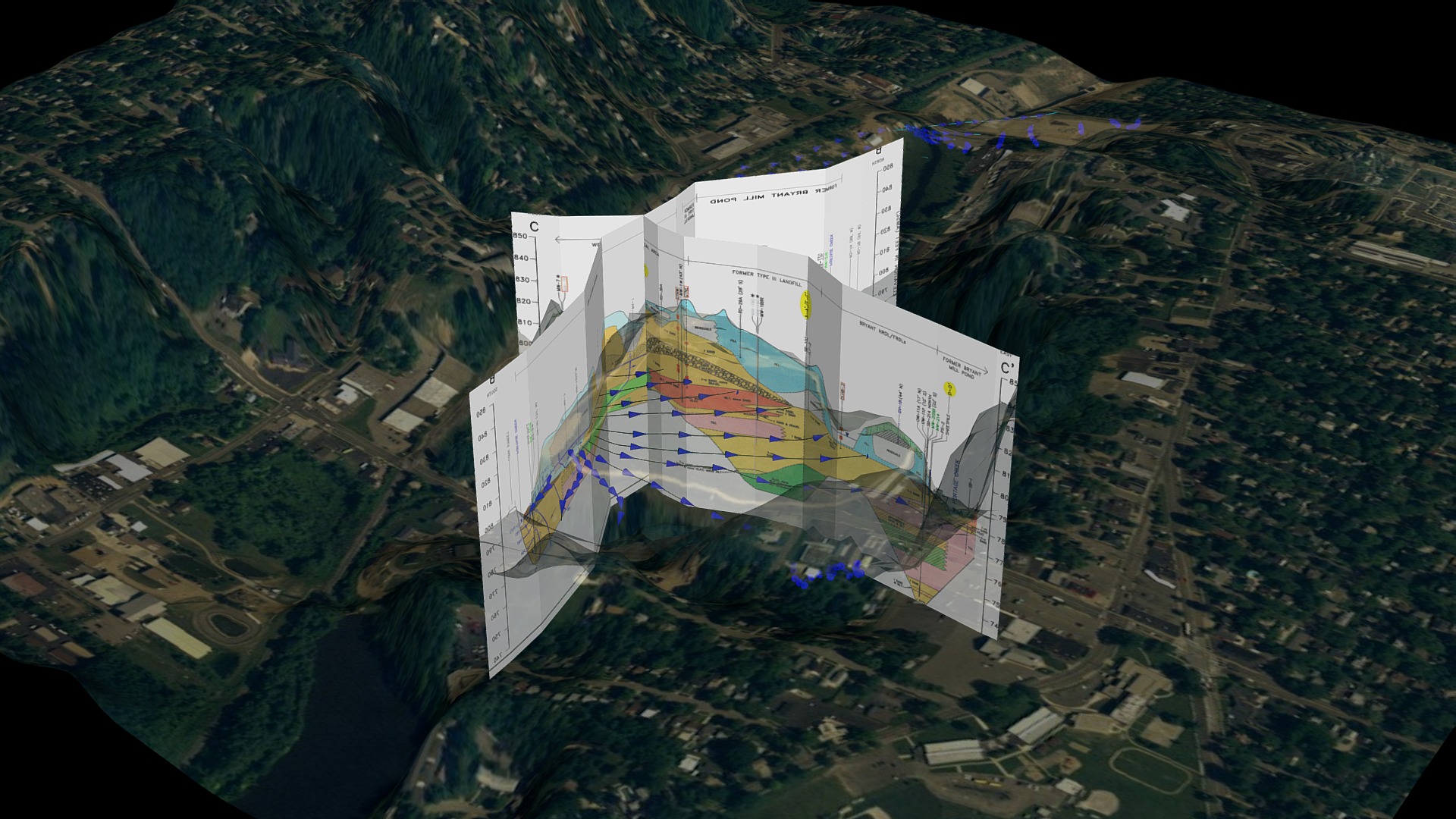
This visualization was crafted by extracting 2D cross sections from a fellow consultant's report, and then geo-referencing and scaling them as three-dimensional objects to create a comprehensive image. A transparent aerial photograph is superimposed on DEM topography for added context, providing a clear understanding of the area's layout. The blue lines and cones signify groundwater flow vectors along the water table, illustrating how they discharge into the creek.
Download Model from sketchfab
With this file you will be able to print 3D Cross Sections with your 3D printer. Click on the button and save the file on your computer to work, edit or customize your design. You can also find more 3D designs for printers on 3D Cross Sections.