3D Map of the City of London
thingiverse
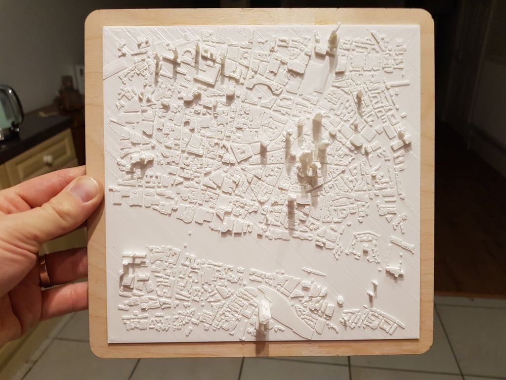
I made this from [Open Streetmap](http://openstreetmap.org) data downloaded in late September 2018. The area covered is almost certainly not the true boundary of the city, rather it is the area I would routinely walk from my office at lunchtime when I worked in the city. The map reaches from Barbican in the northwest to Tower Bridge in the southeast and Liverpool St in the Northeast to Tate Modern in the southwest. There are a number of notable buildings that are modelled really nicely. I particularly like St Pauls Cathedral. Unfortunately, the OSM data for the shard has it as a somewhat square looking thing rather than all thin and pointy but the gherkin is done well as are a number of the buildings around it. The crest on the bottom of the board was based on [an svg file from here](http://logos.wikia.com/wiki/File:City_of_London.svg) but tweaked slightly to make it laser cut a bit more nicely. I followed [these instructions from the OSM wiki](https://wiki.openstreetmap.org/wiki/3D_printing_OSM_data) but used Fusion 360 instead of Blender.
With this file you will be able to print 3D Map of the City of London with your 3D printer. Click on the button and save the file on your computer to work, edit or customize your design. You can also find more 3D designs for printers on 3D Map of the City of London.