3D printable terrain models
prusaprinters
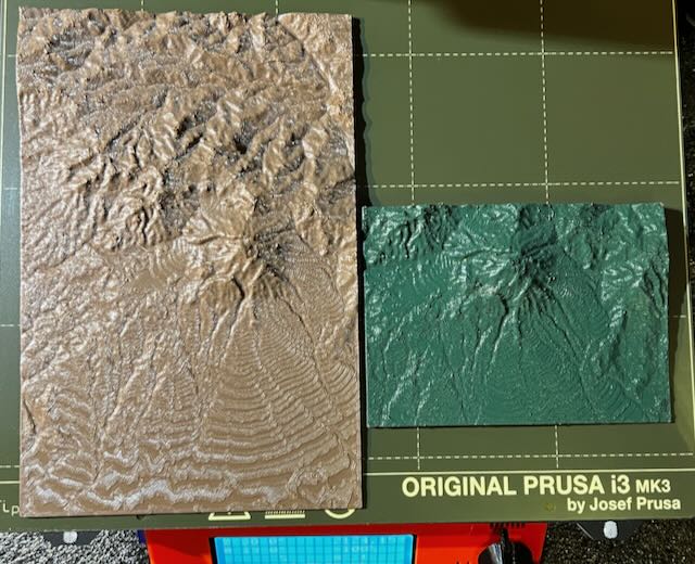
<p>I printed some of these for fun to visualize the volcano that I live near. My geology friends snapped them up and are asking for more. They carry them along on their field trips and find them more useful than flat maps. The layers create an actual contour map, so a defect becomes a feature. They are painting them with important markers and details. </p><p>They are also talking about making a room-sized map of our province, which stretches from the Caribbean to the Pacific. I think it's a great idea, but we need more printers… :)</p><p>These are early ones printed with a .4 nozzle and .2mm layer height. The more refined ones are printed with a .2 nozzle and .1 layer. But they take a LOT more time. All of those are in the hands of the geologists and I am never getting them back. </p><p>The simple site is: <a href="https://jthatch.com/Terrain2STL/">https://jthatch.com/Terrain2STL/</a></p><p>Another site that gives you a lot more control, including mosaics, is: <a href="https://touchterrain.geol.iastate.edu">https://touchterrain.geol.iastate.edu</a></p><p>The maps also allow you to print around water. It would be very cool to make a piece with glass for water, lit from below. And add a light that arcs across the “sky” to mimic the sun. Could be quite a crowd pleaser. </p>
With this file you will be able to print 3D printable terrain models with your 3D printer. Click on the button and save the file on your computer to work, edit or customize your design. You can also find more 3D designs for printers on 3D printable terrain models.