Aerial scan 3 3D model
cgtrader
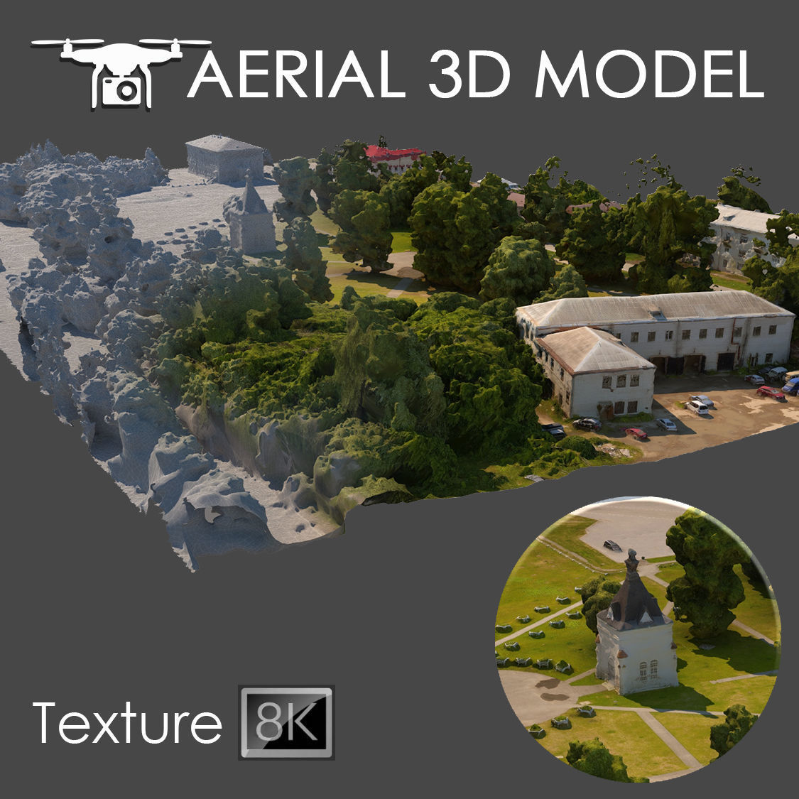
High-accuracy 3D scan taken from directly above using a quadcopter hovering at a steady 60 meters high. The finished product is a detailed model composed of a single Edit Poly, seamlessly covered by an intricate texture that wraps perfectly around the landscape. At 8192x8192 resolution, the scanning data used to create this highly detailed texture gives you a sharp view of even the smallest details found on your surroundings. This highly-detailed model is perfect for getting an in-depth visualization of the terrain at hand when displaying large-scale layouts - think of it as filling in those long-distance perspectives. A great number of small landscape features have been preserved within this model, making sure every inch counts. If you'd like to adjust or refine specific areas of your model, use the Slice modifier, which will enable precise trimming and cutting of any segment needed for your master plan requirements. As with most models of this type, this 3D scan is geared primarily toward pre-planning stages where seeing what works from far out proves helpful; consider using it more in planning over visual details. Compatible files include: 2014 edition 3ds Max files (.MAX), Wavefront Object File format (.OBJ), or FilmBox file (fbx) for export into a range of environments and apps
With this file you will be able to print Aerial scan 3 3D model with your 3D printer. Click on the button and save the file on your computer to work, edit or customize your design. You can also find more 3D designs for printers on Aerial scan 3 3D model.