Alaska Topographic Relief Map
thingiverse
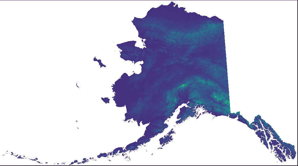
This is an add-on for the lower 48 state puzzle (see parent thing https://www.thingiverse.com/thing:5256690 and the Hawaii add-on https://www.thingiverse.com/thing:5317621). The same scale (1:5000000) and exaggeration (10x) are used to make it "compatible" with the tiles from the parent project. The SRTM elevation data used to make the lower 48 state puzzle and the Hawaii add-on (https://www.thingiverse.com/thing:5317621) does not cover the extreme latitudes required to model Alaska. Fortunately, the ALOS 3D dataset (https://www.eorc.jaxa.jp/ALOS/en/index_e.htm) provides this elevation information.
With this file you will be able to print Alaska Topographic Relief Map with your 3D printer. Click on the button and save the file on your computer to work, edit or customize your design. You can also find more 3D designs for printers on Alaska Topographic Relief Map.