Appalachian Mountains - Pennsylvania
thingiverse
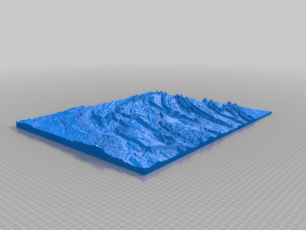
Model was created to explore the relationship between geology and topography (hence the attached geological section for the area). NOTE: Due to the low elevations and the large area that this model is covering it has a vertical exaggeration of 6. High Elevation: 960m Low Elevation: 130m Area: 7978 km2 Instructions This model was generated using a program that is currently being developed. It is based on the GMRT dataset (http://www.marine-geo.org/portals/gmrt/) and utilized the interface from GeoMapApp (http://www.geomapapp.org)
With this file you will be able to print Appalachian Mountains - Pennsylvania with your 3D printer. Click on the button and save the file on your computer to work, edit or customize your design. You can also find more 3D designs for printers on Appalachian Mountains - Pennsylvania.