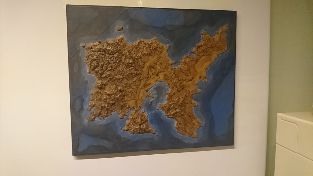
Arma 3 - Altis 3D Map (Made from satellite imagery of Lemnos)
thingiverse
An 3D map of Altis. Source images acquired from: http://terrain.party/ Tutorial (not mine) which goes through the process: https://www.youtube.com/watch?v=cZxyN7esQkY Printed with a 0.4mm nozzle at 0.2mm layer height. Painted to add depth. Your filament choice matters here, I would recommend a matte colour. All 3D modelling was done in Blender. Note: The Z axis is not 100% accurate, it has unknown exaggeration.
With this file you will be able to print Arma 3 - Altis 3D Map (Made from satellite imagery of Lemnos) with your 3D printer. Click on the button and save the file on your computer to work, edit or customize your design. You can also find more 3D designs for printers on Arma 3 - Altis 3D Map (Made from satellite imagery of Lemnos).