Australia 3D Terrain Map
thingiverse
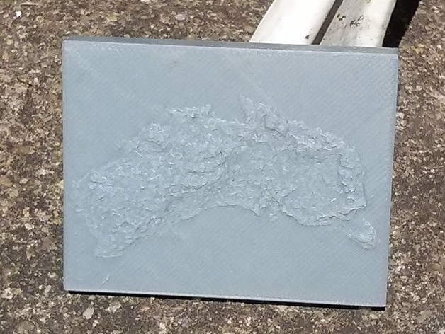
This object was created with a python script I wrote called dem2stl: https://github.com/GeoffWilliams/dem2stl You can use it to convert any jpeg format digital elevation map into a 3D printer STL file. The data for this example object was obtained from GeoScience Australia by selecting the free download at the following page: http://www.ga.gov.au/about-us/news-media/news-2008/new-national-database-simplifies-water-tracking.html The DEM in gallery is a low resolution preview of the data from the above link. Instructions I printed at 100% scale using fine detail. The results wern't perfect but weren't terrible either. Some detail was lost because my printer couldn't handle the resolution. Suggest scaling to a larger size if your printer can handle this or use the above links to download and rescale the data in the stl file. Like this tool/want instructions? Drop me a line
With this file you will be able to print Australia 3D Terrain Map with your 3D printer. Click on the button and save the file on your computer to work, edit or customize your design. You can also find more 3D designs for printers on Australia 3D Terrain Map.