Australia
thingiverse
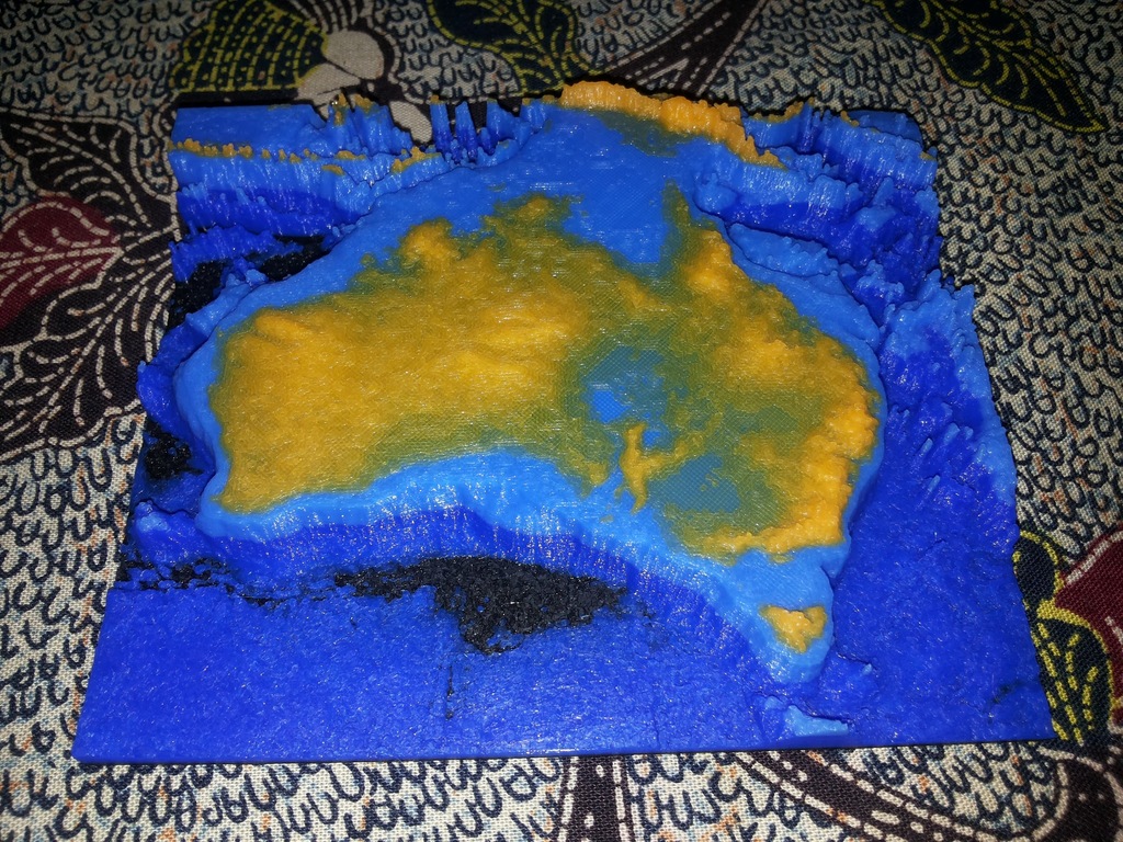
This is a STL file made from the Bathymetry of Australia. The map height has to be exaggerated for 3D printing. If the height was scale proportionally to the longitude / latitude scale (10cm wide for 5500km), the map would only be 0.14mm tall. That's the thickness of a sheet of paper. Map to scale: - Horizontal = From West to East, the map is approximately 5500km. - Vertical = From the deepest ocean to the tallest mountain, this map is only 8km tall. Greyscale image scale: - Black = -6000m - White = 2000m The coastline is exactly at 2/3 of the total height. This is how I created the STL file: 1. I created a greyscale image from the Bathymetry, using GeoServer. This step can also be done using QGis or ArcMap. 2. I created a STL file from the greyscale image using the png23d library. Sources: - Bathymetry: http://eatlas.org.au/data/uuid/80301676-97fb-4bdf-b06c-e961e5c0cb0b - png23d: http://kyllikki.github.io/png23d/
With this file you will be able to print Australia with your 3D printer. Click on the button and save the file on your computer to work, edit or customize your design. You can also find more 3D designs for printers on Australia.