Avatar: The Last Airbender Topographic Map
thingiverse
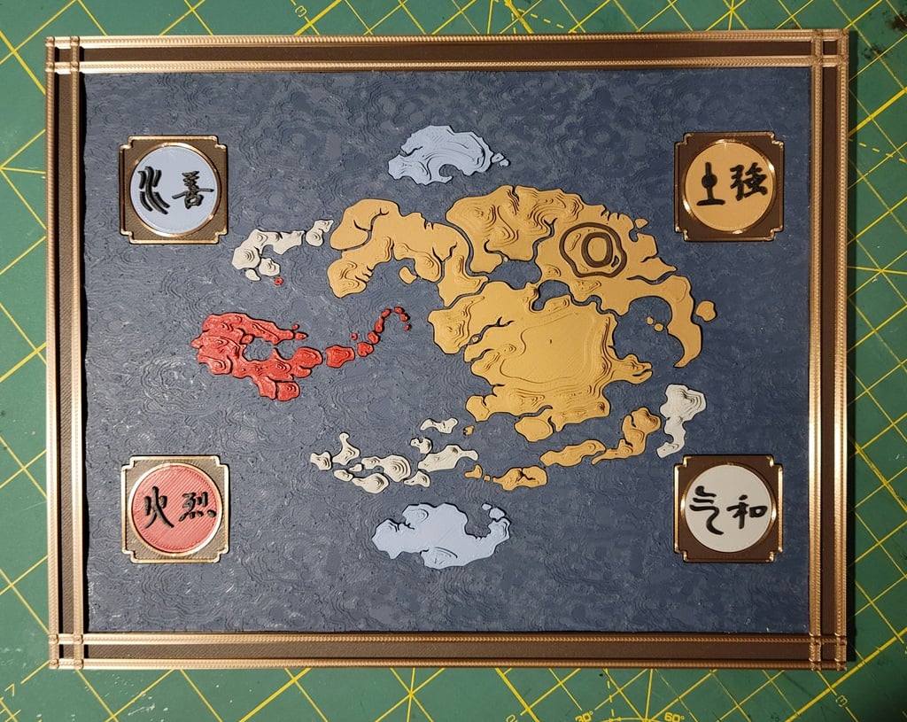
This is a 3D topographic map of the Avatar: The Last Airbender world. In this model, the landmasses print like puzzle pieces that fit into the background- it's done this way to make it as easy as possible to have multiple colors. This map has features that are not included on other maps- You'll be able to find Kyoshi's Island, the Boiling Rock, Roku's Island, and the magnetic center of the Si Wong desert. This is also at a much higher resolution than other available maps, including finder detail regarding both landmass coastline and topology layers. Q: "What's the deal with the 'split' .stl models?" A: Well, there are some very tiny islands that are very close to other very tiny islands. In such cases, even the smallest amount of stringing will cause them to attach in an inconvenient way. Some of the islands are so small that it's even difficult to tell where to trim. For example, the very last island on the Fire Nation island chain will be indistinguishable from the stringing that connects it to its closest neighbor, causing a bit of headache during cleanup. The split models stagger the islands such that this isn't an issue. For me, this was an extremely fun and rewarding build! I highly recommend it.
With this file you will be able to print Avatar: The Last Airbender Topographic Map with your 3D printer. Click on the button and save the file on your computer to work, edit or customize your design. You can also find more 3D designs for printers on Avatar: The Last Airbender Topographic Map.