Canada Map 3d Puzzle
thingiverse
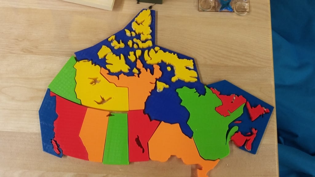
I found several 3d printed puzzle map on the site but none for Canada so I decided to make my own. Using Fusion 360, I imported an svg file of a map i previously found on the internet. I then extruded all the different provinces to make the pieces. To account for the northern islands without over complicating the puzzle made a piece representing the ocean unto which all of the islands can be fitted in their correct locations. Some smaller islands both east, west and north were omitted due to their smaller size. Very well suited for basic geography teaching in all schools or at home, as the students get a physical feel of the provinces and their respective sizes. The process I used to design the map could be adapted to create puzzle maps of pretty much any country or region provided you have a 2d black and white map of it. PS: The model on the picture was partially glued together (the islands part) to make it easier for small children. It works very well)
With this file you will be able to print Canada Map 3d Puzzle with your 3D printer. Click on the button and save the file on your computer to work, edit or customize your design. You can also find more 3D designs for printers on Canada Map 3d Puzzle.