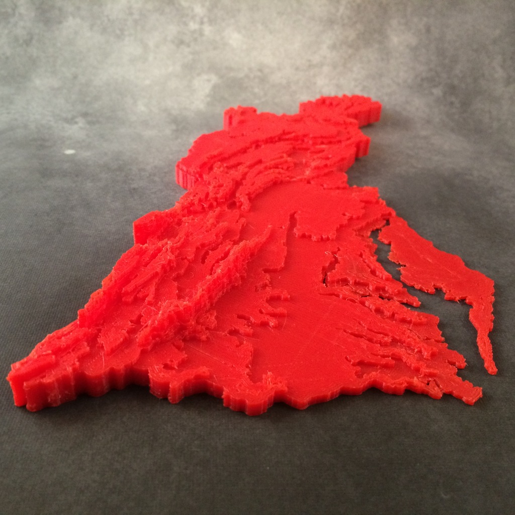
Chesapeake Bay Watershed Contour Map
thingiverse
Contour map of the Chesapeake Bay Watershed made for a summer STEM camp to illustrate the effect of terrain on the flow of water to the Chesapeake Bay. Details about the construction of this map can be found at http://designmaketeach.com/2015/07/02/design-challenge-chesapeake-bay-watershed/ . I need help with developing a simpler technique for creating similar maps for use as educational manipulates. If you can help, please leave a comment or contact me on Twitter @DesignMakeTeach.com This thing was made with Tinkercad. Edit it online https://www.tinkercad.com/things/aq5nCOnZCEA I have also created a laser and paper cut version of the map using the same base set of svg files but have not collected them for publishing yet. There is an error in the file as I was experimented with simplifying the contour lines.
With this file you will be able to print Chesapeake Bay Watershed Contour Map with your 3D printer. Click on the button and save the file on your computer to work, edit or customize your design. You can also find more 3D designs for printers on Chesapeake Bay Watershed Contour Map.