Crater Lake
thingiverse
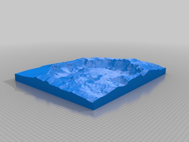
Crater Lake was formed roughly 7,700 years ago by the collapse of Mt. Mazama in Oregon State. It is part of Crater Lake National Park. This model includes both the surrounding topography and the bathymetry of ~655m deep caldera in which the lake resides. The lake level is indicated by a slight line around the basin (this is an artifact of merging two datasets and will be corrected in later versions if necessary). High Elevation: 2480m Low Elevation: 1290m Lake Surface Elevation: 1884m Lake Surface Area: 53 km2 Area: 117 km2 Instructions This model was generated using a program that is currently being developed. It is based on the GMRT dataset (http://www.marine-geo.org/portals/gmrt/) and utilized the interface from GeoMapApp (http://www.geomapapp.org)
With this file you will be able to print Crater Lake with your 3D printer. Click on the button and save the file on your computer to work, edit or customize your design. You can also find more 3D designs for printers on Crater Lake.