Customizable Extrusion Map of Northeast US States
thingiverse
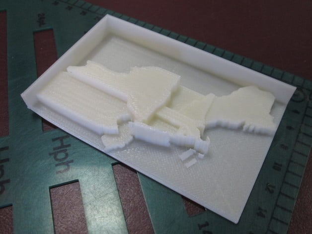
Important Tip: Customizer is exceedingly sensitive to number formatting. It will fail to work correctly if you enter values ending with a decimal point or a trailing zero after the decimal. For example, 10 or 10.5 is OK, but 10., 10.0, or 10.50 will cause Customizer to fail. Open in Customizer and enter new values for each state to create your own extruded thematic map (also called a "prism map"). Naturally, I plan to post templates for a variety of other regions. I am writing a script called Prismap to convert shapefiles of arbitrary areas to these customizable OpenSCAD templates. So, you will be able to use Prismap to make printable prism maps of areas of your choice - states, counties, countries, election districts, etc. Or, just let me know your area of interest and I may be able to prepare a template for you. State boundaries derived from Natural Earth Data. For better resullts, simplify geometry, prune small features, and reproject shapefiles as desired before processing with Prismap. Thanks to dddjournal for the test print photo!
With this file you will be able to print Customizable Extrusion Map of Northeast US States with your 3D printer. Click on the button and save the file on your computer to work, edit or customize your design. You can also find more 3D designs for printers on Customizable Extrusion Map of Northeast US States.