Customizable Topo Map Stand
thingiverse
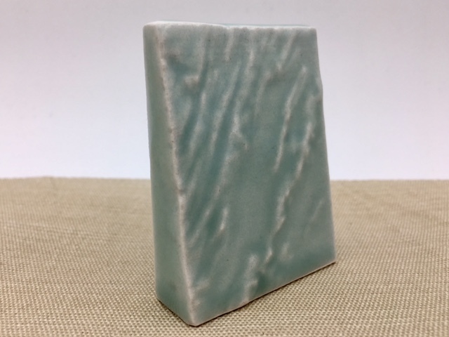
This customizer creates a labeled backing stand that is designed for use in conjunction with exports of topographic map regions from Terrain2STL, a powerful tool for generating terrain maps. The model creates the stand itself, but you will need to export your own terrain map from Terrain2STL and size it to match the stand. Once the map and stand are sized correctly, they can be joined together in Meshmixer to create the final design for printing. For an easier approach, download the included OpenSCAD code and modify it directly; this will allow you to import your exported map and compare sizes within OpenSCAD. The example pictured was printed in Porcelain and glazed in Celedon Green at Shapeways, showcasing the beautiful Shenandoah Valley region around Harrisonburg, Virginia. Follow @mathgrrl on Twitter for the latest updates. Visit mathgrrl.com/hacktastic to explore more creative projects. Check out the geekhaus store at shapeways.com/shops/mathgrrl for unique 3D printed items. This design and all associated images and files are licensed under the Creative Commons Attribution Non-Commercial Share Alike license. If you need to use designs, images, or files outside of this license, email request@mathgrrl.com.
With this file you will be able to print Customizable Topo Map Stand with your 3D printer. Click on the button and save the file on your computer to work, edit or customize your design. You can also find more 3D designs for printers on Customizable Topo Map Stand.