Demo Twente Airbase
sketchfab
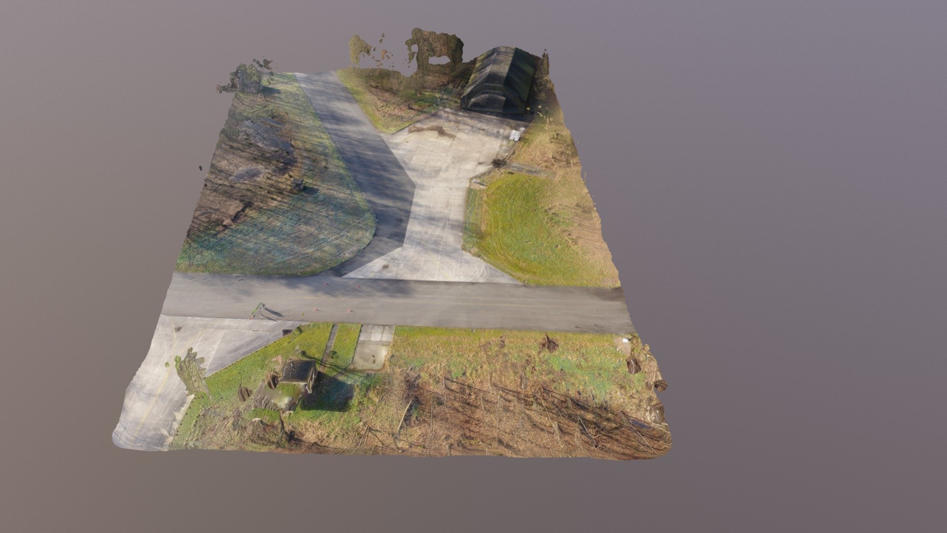
Here's a Quick Flight by Drone to Demonstrate Drone Mapping and 3D Modeling Using Drone Data, Featuring the Twente Airbase and Bunker. A Brief, Exciting Journey Aboard AlfaDrone Reveals the Power of Drone Mapping Technology and Its Ability to Create Highly Accurate 3D Models from Raw Drone Data. In This Instance, We Visit the Twente Airbase, a Complex Facility with a Mysterious Bunker that Beckons Explorers. As Our Drone Soars Over the Twente Airbase, It Captures Stunning Aerial Views of the Entire Facility, Including the Towering Buildings and the Bunker's Entrance. With its Advanced Sensors and Cameras, AlfaDrone Is Able to Create an Extremely Detailed 3D Model of the Area, Down to the Smallest Features. The Resulting 3D Model is a Masterpiece of Drone Mapping Technology, with Every Aspect of the Twente Airbase and Bunker Precisely Mapped and Documented. This Level of Detail Allows for Accurate Analysis and Measurement, Making It an Essential Tool for Architects, Engineers, and Anyone Who Needs to Understand Complex Environments. By Demonstrate the Capabilities of AlfaDrone and Drone Mapping Technology, We Hope to Inspire a New Generation of Explorers, Mappers, and Innovators to Push the Boundaries of What Is Possible with Drones. Join Us on This Exciting Journey and Discover the Power of Drone Mapping for Yourself!
With this file you will be able to print Demo Twente Airbase with your 3D printer. Click on the button and save the file on your computer to work, edit or customize your design. You can also find more 3D designs for printers on Demo Twente Airbase.