Distorted Map Art
prusaprinters
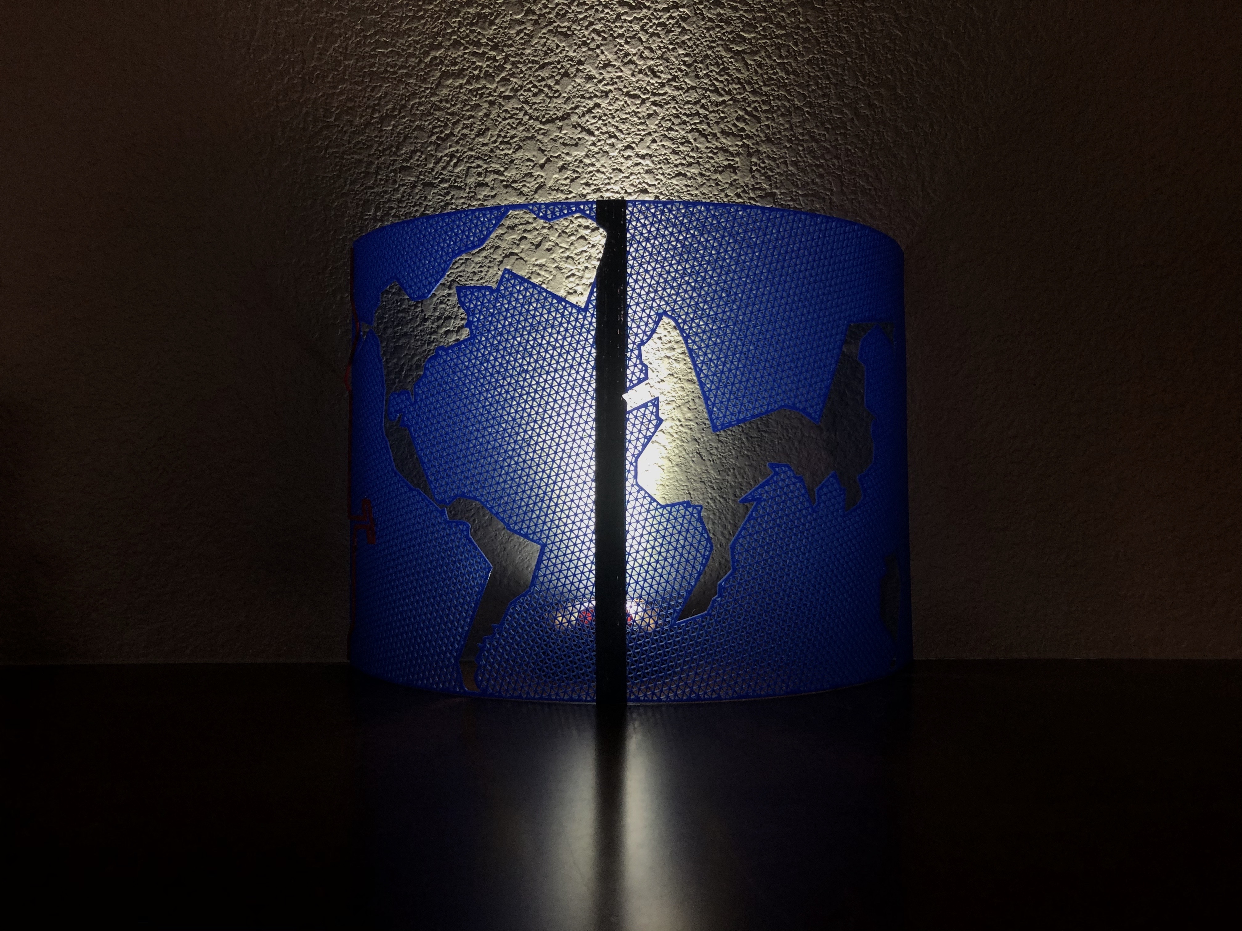
<h3>Distorted Map Art</h3><h4>Background</h4><p>I created this model for a school project years ago. It is a map of the world with distorted continents. The larger ocean size is meant to represent the connectedness of the world across the ocean and how the ocean is the way that humans connect with each other. The International Date Line introduces an element of separation by representing how we are different because of time zones. But still, the world coordinates to keep time consistent, and it can be seen as another element of connectedness.</p><p> </p><h4>Print Settings</h4><p>Print the map with 0 top and 0 bottom layers. I used triangle infill at 50% to get the look in the photos, but if you play around with the settings and create something interesting, please post a make!</p><p>I had to print the map in two parts to fit on my printer.</p>
With this file you will be able to print Distorted Map Art with your 3D printer. Click on the button and save the file on your computer to work, edit or customize your design. You can also find more 3D designs for printers on Distorted Map Art.