Dod Law Main Rock A (July 2007)
sketchfab
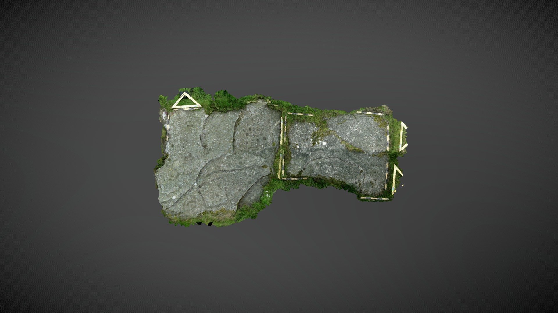
Large area of outcrop found near Wooler Golf Club to the southeast of Doddington, Northumberland. This fairly flat exposure currently (Jan 2018) measures around 5m x 2.5m and is located between two Iron Age camps on Dod Law. Recorded by Tate in the mid-19thC, the surface has various motifs belonging to the North Atlantic repertoire. In addition to the more traditional cup and rings, a number of unusual sub-rectangular enclosing grooves are also present. Recorded as ‘Dod Law Main Rock A’ on the Beckensall Archive, it was added to ERA in 2008: https://archaeologydataservice.ac.uk/era/section/panel/overview.jsf?eraId=49 It isn’t clear whether the carving forms part of Historic England’s scheduling, as it sits between designated areas: https://historicengland.org.uk/listing/the-list/list-entry/1002946 Model created from 16 stereo pairs captured by Kevin Malloy in June 2007 using a 5mp Nikon Coolpix 5400. The imagery forms part of the NADRAP / ERA archive.
With this file you will be able to print Dod Law Main Rock A (July 2007) with your 3D printer. Click on the button and save the file on your computer to work, edit or customize your design. You can also find more 3D designs for printers on Dod Law Main Rock A (July 2007).