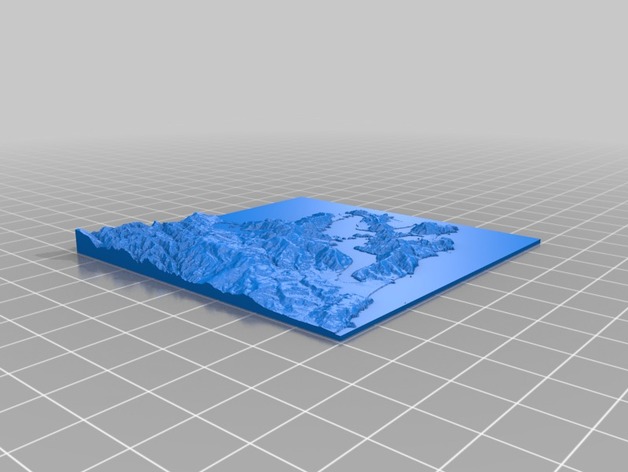
Elevation model of Dunedin, New Zealand.
thingiverse
Elevation model of Dunedin, New Zealand. Created using University of Otago School of Surveying 15m DEM. [UPDATED 4-2017] Fixed aspect ratio on texture and model to make both square and remove distortion. Instructions Made depth map using University of Otago School of Surveying 15m DEM. https://koordinates.com/supplier/university-of-otago-national-school-of-surveying/data/ Black= low elevation, white = high. Used displace function in Blender to create a 3D mesh using the elevation model.
With this file you will be able to print Elevation model of Dunedin, New Zealand. with your 3D printer. Click on the button and save the file on your computer to work, edit or customize your design. You can also find more 3D designs for printers on Elevation model of Dunedin, New Zealand..