Elevation Profile for Grand Junction, CO area
thingiverse
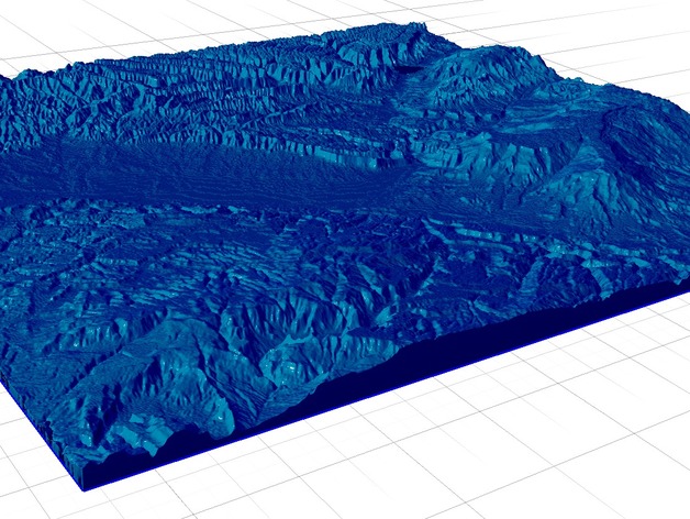
Elevation profile for Grand Junction, CO Instructions Height map generated using earthexlorer.usg.gov Datasets Tab-> Digital Elevation->SRTM Void Filled, Then use MicroDem to process the data to a Grayscale Elevation map. Then use heightmap2stl.jar (Settings were 110 height and 5 thickness) to create the STL.
Download Model from thingiverse
With this file you will be able to print Elevation Profile for Grand Junction, CO area with your 3D printer. Click on the button and save the file on your computer to work, edit or customize your design. You can also find more 3D designs for printers on Elevation Profile for Grand Junction, CO area.