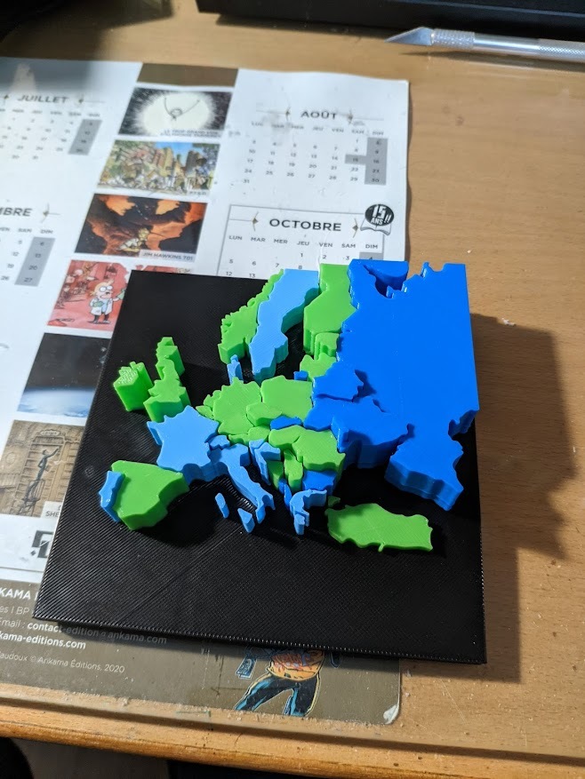
Europe Map Height visualization
thingiverse
Generating with F360, using parameters. A parameter for each country, change the value and the height is generated based on it. [Parameters Guide](https://knowledge.autodesk.com/search-result/caas/CloudHelp/cloudhelp/ENU/Fusion-Model/files/modify-parameters/SLD-MODIFY-CHANGE-PARAMETERS-html.html) Work developed in the InfoVys Course 2021/2022, Homework 5 (Physical Visualization)
Download Model from thingiverse
With this file you will be able to print Europe Map Height visualization with your 3D printer. Click on the button and save the file on your computer to work, edit or customize your design. You can also find more 3D designs for printers on Europe Map Height visualization.