Everest & 1953 Ascent Route (Dual Color)
thingiverse
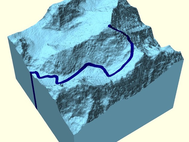
Everest - crafted from NASA SRTM data (1 arcsec) - plus a recreation of the 1953 Ascent Route (Norgay and Hillary) - Dual Color Print. Information Generated from NASA SRTM data (1 arcsec). XYZ scale is approximately 1:100,000. This project is quite extensive (90x90x88mm). It might be helpful to print at 50% first! The 1953 route is based on the map shown on page 9 of:http://www.rgs.org/nr/rdonlyres/22a09637-b5c9-4c44-8110-77126083ded9/0/everest53.pdf The code used to create the two STL files is available on GitHub:https://github.com/PaulZC/Dual_Color_SRTM_and_GPX_to_STL This project aims for artistic representation. If you are planning to climb Everest, you will require more accurate maps and data than this! Please accept this as a representation of the 1953 ascent of Everest. If you have enjoyed this piece, please make a small contribution to:http://himalayantrust.co.uk/donate/
With this file you will be able to print Everest & 1953 Ascent Route (Dual Color) with your 3D printer. Click on the button and save the file on your computer to work, edit or customize your design. You can also find more 3D designs for printers on Everest & 1953 Ascent Route (Dual Color).