Faulted And Tilted Strata A-B Section
sketchfab
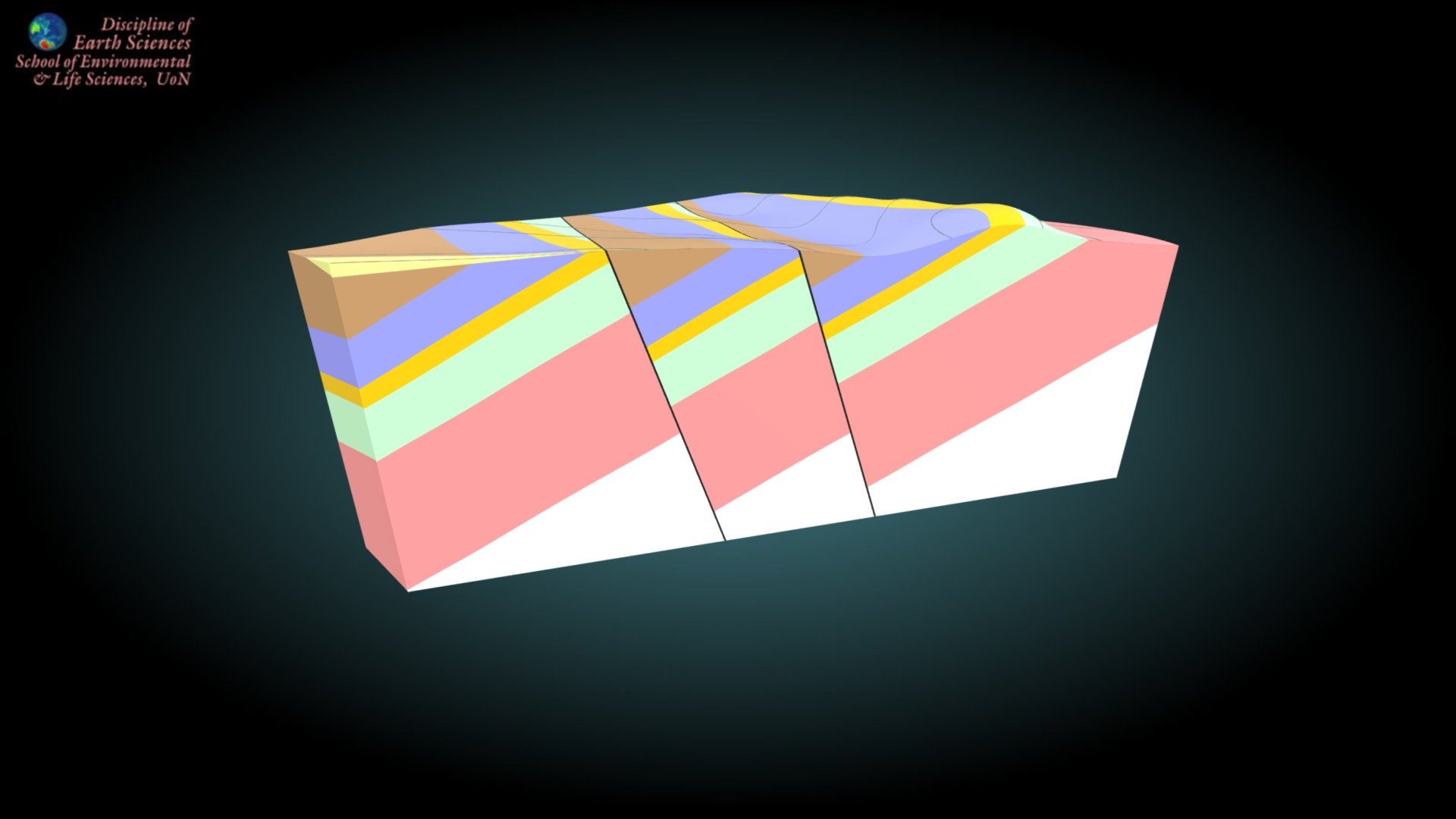
Second year Earth Science students at UoN are presented with a surface map of this region but no structural information is provided. They must calculate the dip and strike of the strata and faults using structure contours, then construct a cross-section through the center (the front face of the model shown here). The topographic surface represents an area approximately 3.6 × 3.5 kilometers in size (scale 1:20,000). Initially, the view is directed toward the northeast corner of the map area. Contour intervals are 100 meters apart.
With this file you will be able to print Faulted And Tilted Strata A-B Section with your 3D printer. Click on the button and save the file on your computer to work, edit or customize your design. You can also find more 3D designs for printers on Faulted And Tilted Strata A-B Section.