Fish River Canyon Namibia Topographic Map
prusaprinters
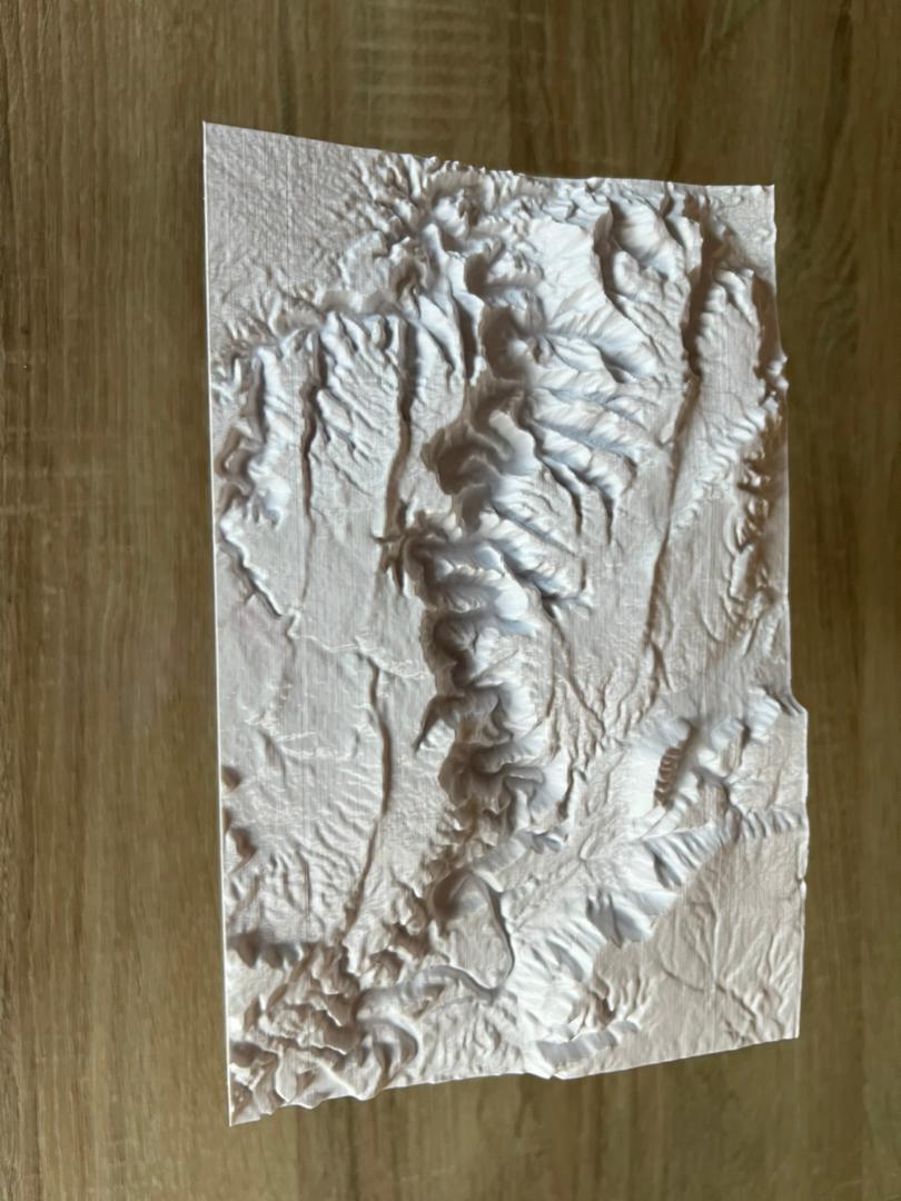
<p>This is a topographic map of the Fish River Canyon in Namibia that I created using https://touchterrain.geol.iastate.edu/</p><p> </p><h3><strong>Print Settings</strong></h3><p><strong>Printer Brand:</strong></p><p>Creality</p><p><strong>Printer:</strong></p><p>CR-10 v1</p><p><strong>Resolution:</strong></p><p>0.16</p><p><strong>Infill:</strong></p><p>10</p><p><strong>Speed:</strong></p><p>35mm/s</p><p><strong>Filament:</strong></p><p>Sa filament PLA Plus</p><p> </p><p>Scaled down to 50% and printed on it's side along the y-axis for better quality with a brim with a line count of 30.</p>
With this file you will be able to print Fish River Canyon Namibia Topographic Map with your 3D printer. Click on the button and save the file on your computer to work, edit or customize your design. You can also find more 3D designs for printers on Fish River Canyon Namibia Topographic Map.