France topographic map
thingiverse
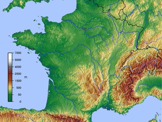
France (and nearby area) topographic 3d model I interpolated the elevation data using Matlab from the following 2D map.https://en.wikipedia.org/wiki/Geography_of_France#/media/File:600x600_GMT_France_topo-R1.jpg Enjoy!
Download Model from thingiverse
With this file you will be able to print France topographic map with your 3D printer. Click on the button and save the file on your computer to work, edit or customize your design. You can also find more 3D designs for printers on France topographic map.