Grand Canyon South Corridor 3d topo
myminifactory
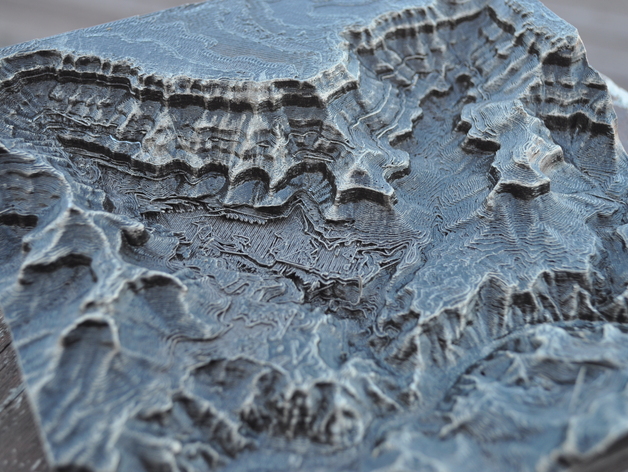
This is a 3d topo map of the south corridor area of the Grand Canyon of the Colorado River. This map covers the area of the Village, Phantom Ranch, and the South Kaibab and Bright Angel trails.The sample was printed using Prototype Supply PLA on a Printerbot Metal Simple. The print was finished with oil-rubbed bronze color Rustoleum spray paint and dry-brush highlighted with silver Guilder's Paste.We talked about this finishing technique and a whole lot more about 3d printing on the 3D Printing Today podcast available on iTunes, Stitcher radio or direct from the source at http://threedprintingtoday.libsyn.com/ You can watch a video tutorial about how to make your own miniature mountains at https://www.youtube.com/watch?v=bzwybr65I9oComplete instructions on how to make models from digital elevation data can be found on my blog at http://www.the3dprintedfuture.com/shapespeare/?p=1
With this file you will be able to print Grand Canyon South Corridor 3d topo with your 3D printer. Click on the button and save the file on your computer to work, edit or customize your design. You can also find more 3D designs for printers on Grand Canyon South Corridor 3d topo.