Great Salt Lake Topography (1986)
prusaprinters
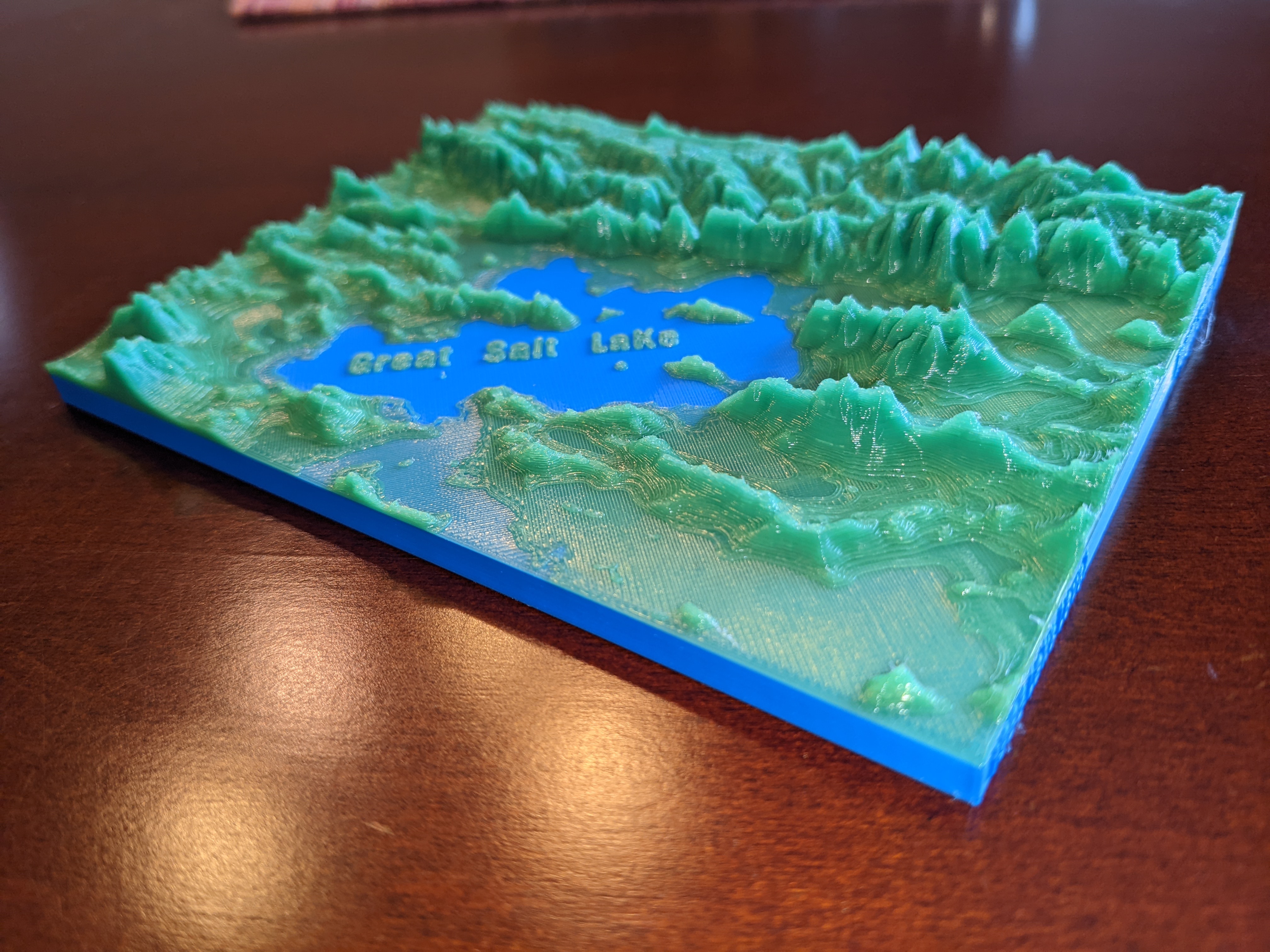
<p>From Wikipedia:</p><p>“The <strong>Great Salt Lake</strong> is the largest <a href="https://en.wikipedia.org/wiki/Salt_lake_(geography)">saltwater lake</a> in the <a href="https://en.wikipedia.org/wiki/Western_Hemisphere">Western Hemisphere</a>,<a href="https://en.wikipedia.org/wiki/Great_Salt_Lake#cite_note-Britannica-1">[1]</a> and the eighth-largest <a href="https://en.wikipedia.org/wiki/Sink_(geography)">terminal lake</a> in the world.<a href="https://en.wikipedia.org/wiki/Great_Salt_Lake#cite_note-USGS-GSL-2">[2]</a> It lies in the northern part of the <a href="https://en.wikipedia.org/wiki/U.S._state">U.S. state</a> of <a href="https://en.wikipedia.org/wiki/Utah">Utah</a>, and has a substantial impact upon the local <a href="https://en.wikipedia.org/wiki/Climate">climate</a>, particularly through <a href="https://en.wikipedia.org/wiki/Lake-effect_snow">lake-effect snow</a>. It is a remnant of <a href="https://en.wikipedia.org/wiki/Lake_Bonneville">Lake Bonneville</a>, a prehistoric body of water that covered much of western Utah.”</p><p>This terrain was generated using <a href="https://touchterrain.geol.iastate.edu/">https://touchterrain.geol.iastate.edu/</a> I added the labels and exaggerated the depth of the lake for clarity. Also included in this topo are the Uinta Mountains, Wasatch Range, Bear Lake, and Utah Lake. Thought about adding more labels, but decided less is more.</p><p>Attached gcode includes a stop/filament change at the lake level.</p>
With this file you will be able to print Great Salt Lake Topography (1986) with your 3D printer. Click on the button and save the file on your computer to work, edit or customize your design. You can also find more 3D designs for printers on Great Salt Lake Topography (1986).