Groovy Yosemite Trail Map
thingiverse
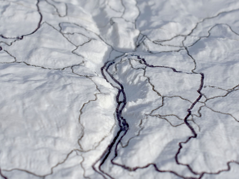
This is a **groovy** 3d map of the entirety of Yosemite National Park showing all the trails, roads, lakes and the national park boundary. You can **print it on a regular single color printer**. The trails and other elements appear in the model as **tiny grooves** which can easily be traced with a fine point marker or technical pen. It prints in 4 parts which are joined by magnets but can be separated easily to be stored in your backpack, or safety deposit box. The assembled map is approx 12"x15" making it a perfect **1:200,000** replica. The terrain is derived from SRTM DEM data. The trails, roads and lakes are derived from OSM data. The park boundary data was supplied by NPS. This map is not to be used for navigation. It may be missing trails and other features and it may show trails and features which are not there. Don't blame me if your favorite trail is missing or your secret trout lake isn't. The sides of the map section have indentations to receive 4mm x 1.5mm rare earth magnets. Depending on your printer the magnets will either press fit in or require a drop of glue. When properly installed they pull the sections together for use while allowing them to be easily broken down and stored. We talked about this and a whole lot more on the **3D Printing Today podcast** available on iTunes, or anywhere else you get podcasts. Learn more at http://www.threedprintingtoday.com/
With this file you will be able to print Groovy Yosemite Trail Map with your 3D printer. Click on the button and save the file on your computer to work, edit or customize your design. You can also find more 3D designs for printers on Groovy Yosemite Trail Map.