Guam Relief Map
thingiverse
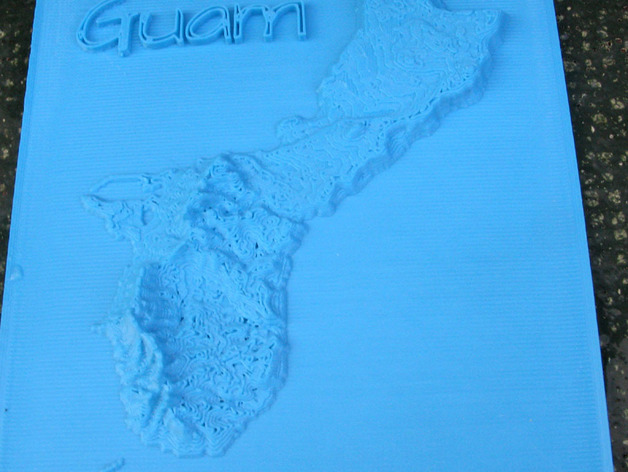
A relief map of Guam was generated using the "surface" command in openSCAD. Data was sourced from 10n120e_20101117_gmted_mea075.tif, which is part of the USGS GMTED2010 dataset available on Earth Explorer. The Guam region was converted into a 210x240 array of real numbers using a Fortran program. OpenSCAD code and the number array are also included. The map spans 1575 by 1800 arc seconds, with Guam measuring approximately 30 miles long. The elevation data ranges from 2 (sea level) to 9.9 (highest point at 1332 feet in Guam), representing the map's thickness in mm.
With this file you will be able to print Guam Relief Map with your 3D printer. Click on the button and save the file on your computer to work, edit or customize your design. You can also find more 3D designs for printers on Guam Relief Map.