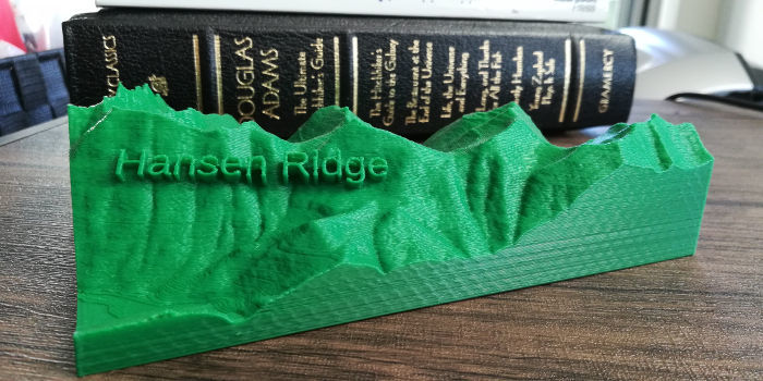
Hansen Ridge Topographical Trail Map
thingiverse
Hansen Ridge is by far my favorite cross country ride anywhere. It’s a reversed lollipop loop along an exposed ridgeline with a cool lake at the end. Maps don’t do it justice, but in 3D you can get a feel for the scale of the ridgelines and epic views you’ll experience here. Choose your layer height based on how dramatic you want the topo effect to be. I personally like the look of 0.2mm as you can trace the topo lines with your eyes, but 0.1mm gets a little cleaner and shows more detail. I have a bunch more maps on my website at [jayspeidell.com/3dtrailmaps](https://jayspeidell.github.io/3dtrailmaps/), and if you'd like a custom design I'd be happy to make it if I have some free time. Do not print and sell these, but feel free to give them away. Just let people know where you got it. Send me a message if you want to work something out.
With this file you will be able to print Hansen Ridge Topographical Trail Map with your 3D printer. Click on the button and save the file on your computer to work, edit or customize your design. You can also find more 3D designs for printers on Hansen Ridge Topographical Trail Map.