Hawaii Relief Map
thingiverse
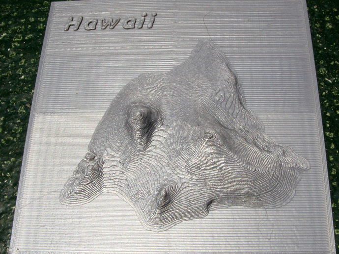
Here is a relief map of Hawaii, the Big Island. It is based on a NOAA digital elevation model or DEM - hawaii_6s_20070806.asc. See - http://www.ngdc.noaa.gov/dem/squareCellGrid/download/460 The data set consists of an array of real numbers with 3000 rows and 4200 columns. The distance between points is 6 arc seconds. A 200 by 200 array, sampled at 30 arc second intervals and surrounding Hawaii, was used to make the stl file. Points below sea level were set to the sea level value. In the model the highest peak rises about 20 mm above sea level. The highest peak on Hawaii, Mauna Kea, is 4200 meters above sea level. NOAA has a portal that helps one find many similar data sets. See http://www.ngdc.noaa.gov/mgg/dem/demportal.html Instructions The file should be printed directly on the build platform. I used three shells to insure smooth tops to the peaks. A fortran program was used to treat the data file. Rather than output an stl file the program writes an openSCAD polyhedron command. This allows the use of openSCAD's thrown together command for debugging. The simple ascii data file made this a nice exercise.
With this file you will be able to print Hawaii Relief Map with your 3D printer. Click on the button and save the file on your computer to work, edit or customize your design. You can also find more 3D designs for printers on Hawaii Relief Map.