Height map to STL demo
thingiverse
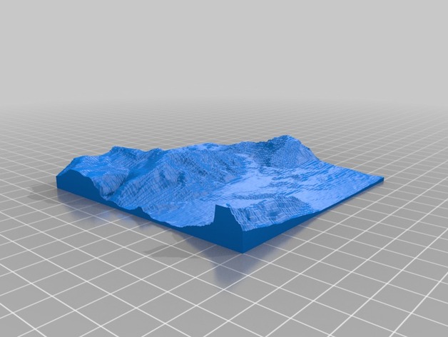
Our team is currently developing a Map to STL converter, and this model was created during the beta phase which was also successfully printed. The print was made on a self-built Reprap Prusa Mendel, so please excuse the low quality. This model displays the landscape around 47.7303361, 12.881588. In the coming days, we will launch a website featuring a map-based converter to generate STL files. Just some final testing is left. For printing, I used Slic3r and experienced good results. However, my print had minor cavities where none should be and numerous small bumps on top of ridges and peaks. To enhance the print's appearance, exaggerated heights could be utilized.
With this file you will be able to print Height map to STL demo with your 3D printer. Click on the button and save the file on your computer to work, edit or customize your design. You can also find more 3D designs for printers on Height map to STL demo.