HGT 2 STL Converter
thingiverse
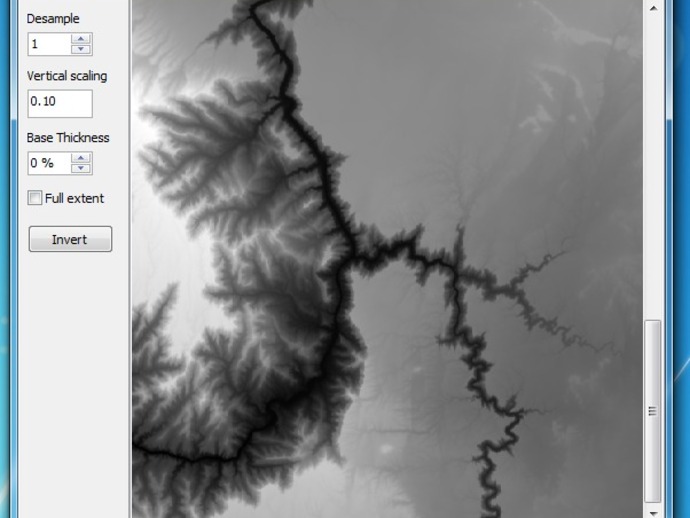
A small program to read Digital Elevation Model HGT files (Space Shuttle Radar Tomography) or Image files and convert them to STLs Instructions *v0.3.0.0 Added support for importing images. These are converted to greyscale and can then be converted to STLs Added a 'base' option that can be trimmed to the object / landmass or cover the full extend of the area. Redesigned the interface.v 0.2.0.0 Rounding error caused some latitudes to generate errors. Fixed in this version.v 0.1.1 Improved error checking - errors can send an error report to me if you choose. HTG files can be downloaded from http://www.viewfinderpanoramas.org/dem3.html. on the map (http://www.viewfinderpanoramas.org/Coverage%20map%20viewfinderpanoramas_org3.htm) select an area to download the zipped tiles for that area. Unzip and select a tile in HGT2STL.exe. A greyscale image of the tile is shown. Water (or actually height = 0) is blue. Draw over an area to export just a portion of the map, set 'Desample' to reduce the resolution of the map. Select 'Save as ASCII STL' to output a map. The program is - and will only ever be - Windows only! Sorry, but that is what I know and use. (Delphi XE3 source is available) Generated STLs are ASCII format. I may add binary in the future - time and interest permitting.... Max resolution for these maps is about 1 facet = 90m. Higher res DEMs are available - for a price! This porgram can only read the HGT format though. Program is quick & dirty - almost NO error checking! PBill4.zip & La Palma are zipped ASCII STLs of the maps shown in the screenshots.
With this file you will be able to print HGT 2 STL Converter with your 3D printer. Click on the button and save the file on your computer to work, edit or customize your design. You can also find more 3D designs for printers on HGT 2 STL Converter.