Ice Age Earth 3D Globe
sketchfab
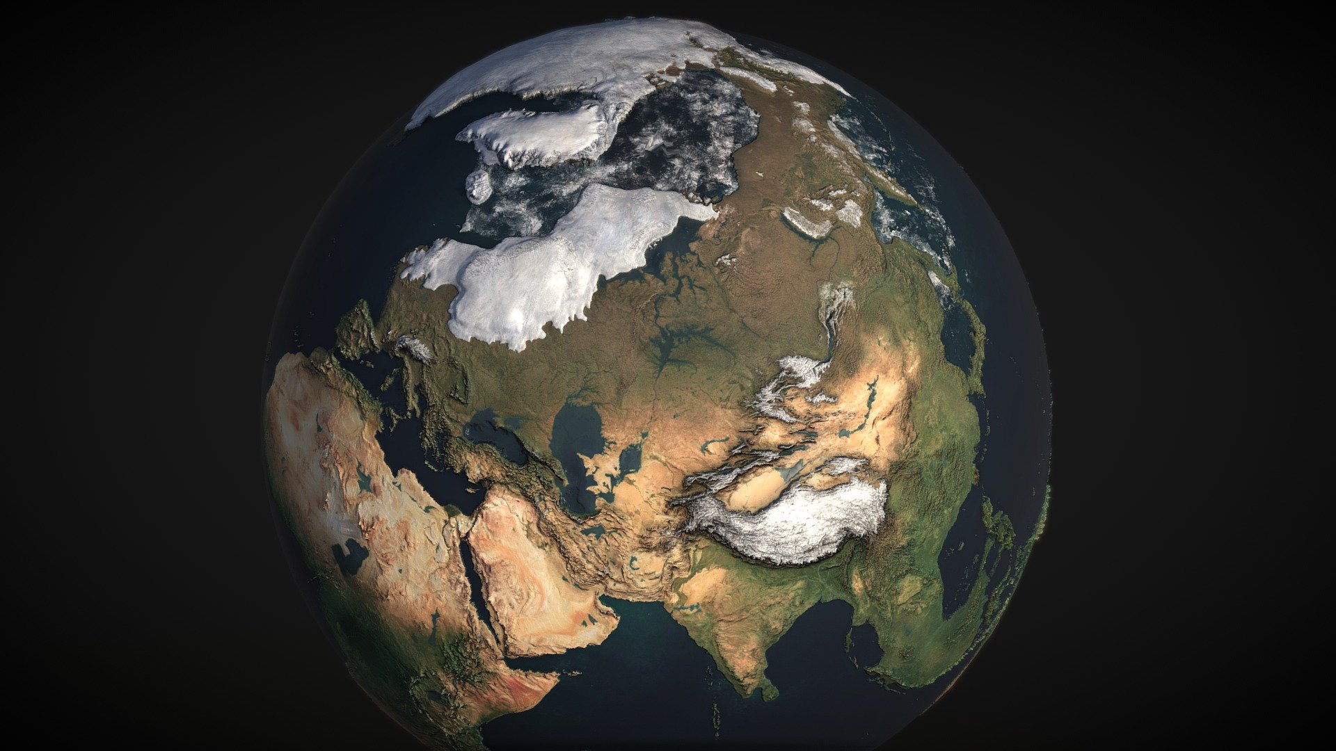
This map shows how the world may have appeared during the Last Glacial Maximum, around 21,000 years ago, when sea levels were approximately 125 meters (410 feet) below present and the ice sheets were at their greatest extent. This is based on a 2d map I made: https://www.deviantart.com/atlas-v7x/art/Ice-Age-Earth-741216561
Download Model from sketchfab
With this file you will be able to print Ice Age Earth 3D Globe with your 3D printer. Click on the button and save the file on your computer to work, edit or customize your design. You can also find more 3D designs for printers on Ice Age Earth 3D Globe.