infographic of world map based on good countries index (2017)
pinshape
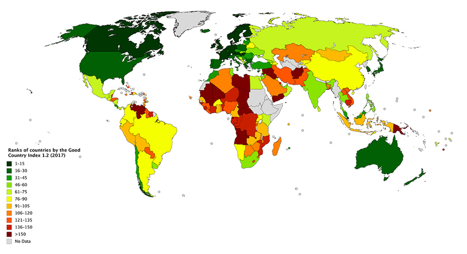
This is a 3d printed world map based on ranks of countries by the Good Country Index 1.2 (2007). You can find more information on Wikipedia: https://en.wikipedia.org/wiki/Good_Country_Index I have changed each color to a specific height. so, the higher the altitude, the better the country. It is possible to add color to the printed object too. but it is a work of art and I didn't do it. I have designed the whole world map using "Solidworks". so, I can use this method to show any index, e.g. GDP, population, ... about countries.
With this file you will be able to print infographic of world map based on good countries index (2017) with your 3D printer. Click on the button and save the file on your computer to work, edit or customize your design. You can also find more 3D designs for printers on infographic of world map based on good countries index (2017).