Lake Superior Depth Map
prusaprinters
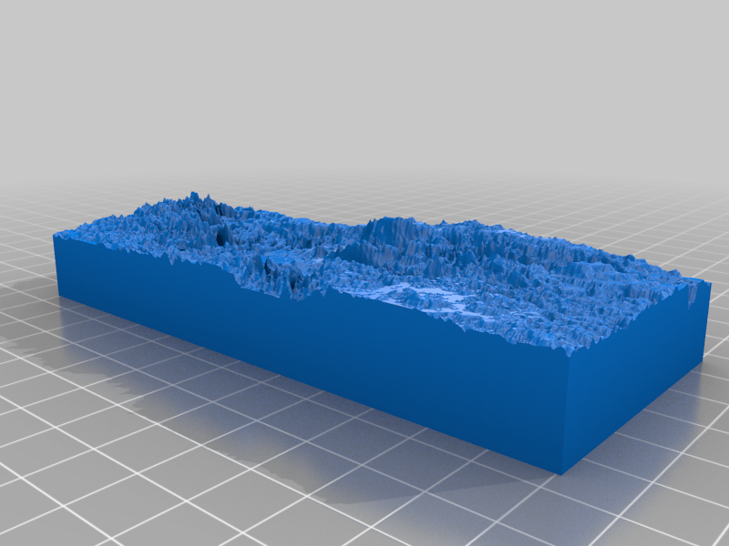
<p>I wanted a depth map of Lake Superior and was able to find <a href="https://www.thingiverse.com/thing:3570708">https://www.thingiverse.com/thing:3570708</a> which had the other Great Lakes but was missing Lake Superior. Fortunately, it included a link to the data set (<a href="https://www.ngdc.noaa.gov/mgg/greatlakes/">https://www.ngdc.noaa.gov/mgg/greatlakes/</a>). I was able to take the dataset and use a quick application I wrote to turn the data into a grey-scale height map which I could then use Cura to turn into a lithophane of sorts which I used to make this model.</p> <h3>Print Settings</h3> <p><strong>Printer:</strong></p> <p>Sovol SV01</p> <p class="detail-setting rafts"><strong>Rafts: </strong> <div><p>No</p></div> <p><strong>Supports:</strong></p> <p>No</p> <p class="detail-setting resolution"><strong>Resolution: </strong> <div><p>200</p></div> <p><strong>Infill:</strong></p> <p>25</p> <p><strong>Filament:</strong></p> HATCHBOX PLA <p>White</p> </p></p> Category: Scans & Replicas
With this file you will be able to print Lake Superior Depth Map with your 3D printer. Click on the button and save the file on your computer to work, edit or customize your design. You can also find more 3D designs for printers on Lake Superior Depth Map.