Land Globe 200x in 500,000 Facets
thingiverse
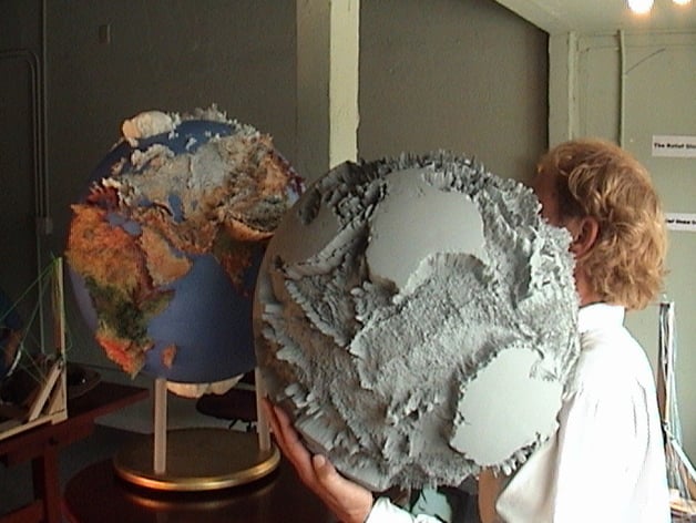
The land of Earth is shown with smooth oceans. Exaggerated elevations are 200 times taller than normal. Data points occur every half degree of latitude and longitude. The ETOPO2 database was used. The photo shows GlobeMaker carrying a Seafloor Globe 150x SLA Master as Atlas would have done it. The Land Globe 300x is seen in the left and it is similar to the Thing (Land Globe 200x). Originator: National Geophysical Data Center (NGDC) Originator: ESRI Publication_Date: 20040301 Title: Global Digital Elevation Model (ETOPO2) Edition: 2004 Geospatial_Data_Presentation_Form: raster digital data Series_Information: Series_Name: ESRI® Data & Maps Issue_Identification: 2004 Publication_Information: Publication_Place: Redlands, California, USA Publisher: ESRI Other_Citation_Details: Location: worldelevation Description: Abstract: Global Digital Elevation Model (ETOPO2) represents gridded (2 minute by 2 minute) elevation and bathymetry for the world. These data were derived from the National Geophysical Data Center (NGDC) ETOPO2 Global 2' Elevations data set from September 2001.
With this file you will be able to print Land Globe 200x in 500,000 Facets with your 3D printer. Click on the button and save the file on your computer to work, edit or customize your design. You can also find more 3D designs for printers on Land Globe 200x in 500,000 Facets.