Maiden Castle Iron Age Hillfort LiDAR Model
sketchfab
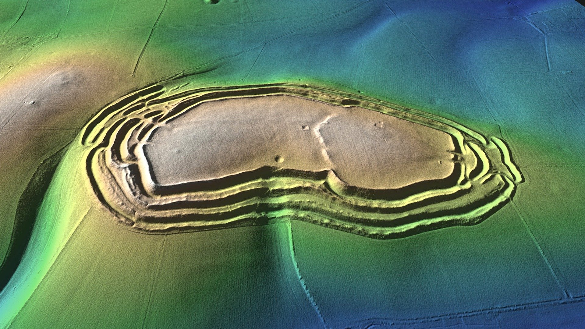
Maiden Castle is a large multivallate hillfort located on a low hill between the river valleys of the Frome and South Winterborne. It lies 2.5km south west of Dorchester in Dorset. The site has been partly excavated by Edward Cunnington (1884), Sir Mortimer Wheeler & Tessa Verney Wheeler (1934-37) and by Niall Sharples (1985-6). The earliest activity on the site includes a Neolithic causewayed enclosure and a unique Bank Barrow. These structures were replaced by subsequent phases of Iron Age hillfort defensive circuits which enclosed a substantial Iron Age settlement occupying the hill top between 600 BC and the first century AD. The site may have been attacked by the Roman army in the 40’s AD although the evidence is inconclusive at present. Large caches of thousands of stone sling stones have been found in pits close to the ramparts. A later 4th century Romano-Celtic temple was built after the Iron Age settlement was abandoned and the site was subsequently used for agriculture in the Medieval period.
With this file you will be able to print Maiden Castle Iron Age Hillfort LiDAR Model with your 3D printer. Click on the button and save the file on your computer to work, edit or customize your design. You can also find more 3D designs for printers on Maiden Castle Iron Age Hillfort LiDAR Model.