Maine, USA of Plastic
thingiverse
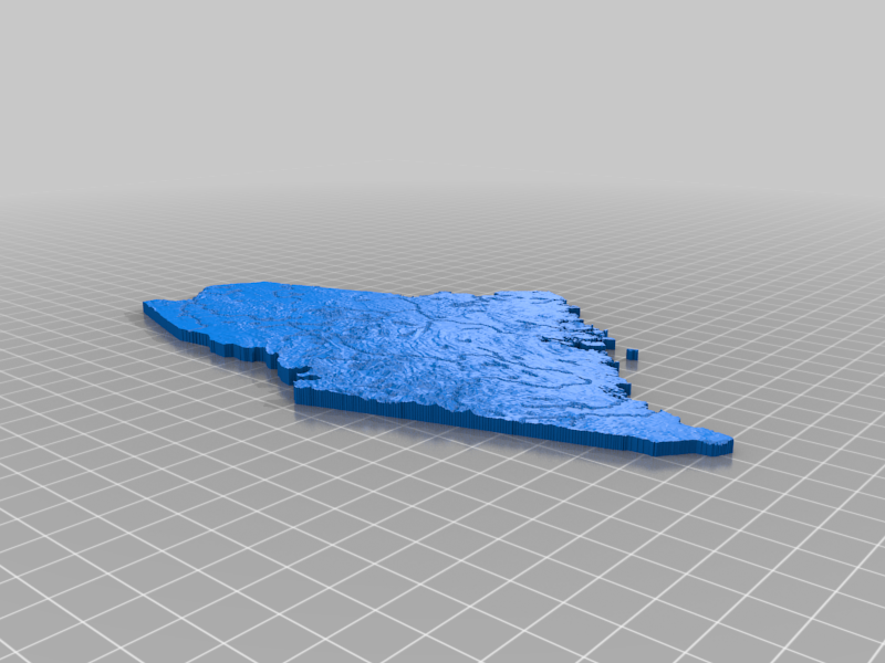
A topo map of Maine, USA. Lower poly version due to file size limitations. As seen at https://www.reddit.com/r/3Dprinting/comments/sp7ncs/converted_satellite_data_to_an_interlocking_topo/ Data: USGS GMTED2010, Hydro1k, HydroSHEDS HydroLAKES STL was originally generated from a 500m resolution DEM and decimated with a 0.1 ratio to make it easier to transfer online. As a result, the smallest detail on this model in real life is approximately 5000 m horizontally. 1:2500000 horizontal scale 1:500000 vertical scale USA Contiguous Lambert Conformal Conic 7.5 arc second GMTED downscaled to 500m using cubic Streams and lakes lowered by 0.5 mm
With this file you will be able to print Maine, USA of Plastic with your 3D printer. Click on the button and save the file on your computer to work, edit or customize your design. You can also find more 3D designs for printers on Maine, USA of Plastic.