Moel Y Gaer Hillfort; Wales
sketchfab
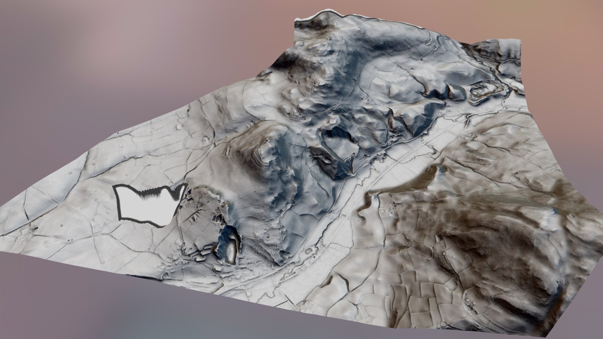
Moel Y Gaer (Bodfari) is the lowest of the Clwydian hillforts at c 200m, positioned outside the village of Bodfari, 5 miles north-east of Denbigh in the northern Clwydian Range. It is situated on the top of a discrete hill strategically located overlooking the confluence of the Rivers Chwiler and Clwyd with an enclosed area of cca 2ha. North of hillfort is clearly visiable enclousure. Can be also seen on some Google sattelite pictures. More about it here http://www.walesher1974.org/herumd.php?group=CPAT&level=3&docid=301364142 http://www.megalithic.co.uk/article.php?sid=5979 Used 2 metre DTM LiDAR data from Natural Resources Wales. Thanks to Mike Gill (Avon Valley Archaeological Society) for the python coding https://github.com/mike-gill/qgis2sketchfab
With this file you will be able to print Moel Y Gaer Hillfort; Wales with your 3D printer. Click on the button and save the file on your computer to work, edit or customize your design. You can also find more 3D designs for printers on Moel Y Gaer Hillfort; Wales.