More Hawaiian Relief Maps
thingiverse
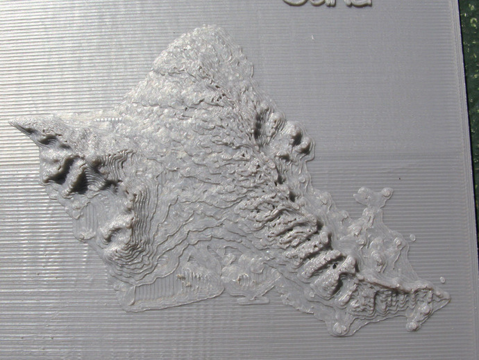
Here are four additional relief maps of the Hawaiian islands. The maps are based on the same NOAA data,http://www.ngdc.noaa.gov/dem/squareCellGrid/download/460, as the map of "The Big Island" - hawaii.stl - thing:105474. The NOAA file was sampled at intervals of 12 arc seconds to give the following files - maui.stl ------------ 200 rows x 220 columns molokai_lanai.stl - 200 rows x 220 columns oahu.stl ------------ 200 rows x 220 columns kauai.stl ----------- 150 rows x 300 columns The vertical scale is a little over 200 meters per mm. Instructions The files can be printed directly on the build surface. Added fixes - Added source, hawaii_maps_v3.f, and two new relief maps where a step in height was added at sea level, oahu_step.stl and maui_step.stl. See images above; old and new versions are available.
With this file you will be able to print More Hawaiian Relief Maps with your 3D printer. Click on the button and save the file on your computer to work, edit or customize your design. You can also find more 3D designs for printers on More Hawaiian Relief Maps.