Motatapu MTB ride
thingiverse
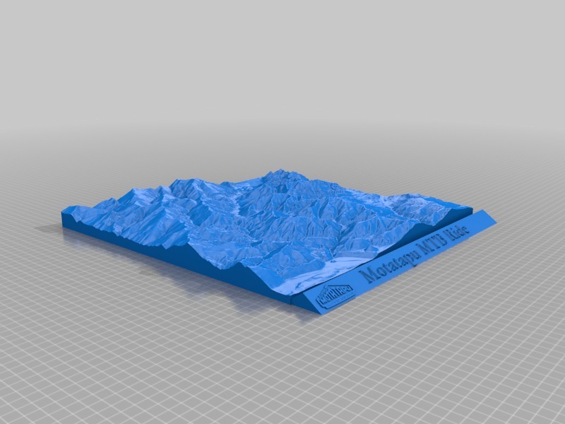
Topographical relief map of area between Wanaka / Glendhu Bay and Arrowtown showing the Motatapu MTB track. Topographical data: Sourced from the LINZ Data Service http://data.linz.govt.nz/layer/772-nz-primary-parcels and licensed by LINZ for re-use under the Creative Commons Attribution 3.0 New Zealand licence.
Download Model from thingiverse
With this file you will be able to print Motatapu MTB ride with your 3D printer. Click on the button and save the file on your computer to work, edit or customize your design. You can also find more 3D designs for printers on Motatapu MTB ride.