Mount Sakurajima
thingiverse
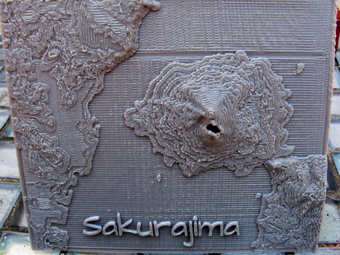
Here is a relief map of Mount Sakurajima. Sakurajima is an active volcano situated on a peninsula in Kagoshima Bay, Japan. The volcano has been active all year and had a spectacular eruption on August 18th which reached an altitude of 5000 meters. The city of Kagoshima, a few kilometers to the west, was covered in ash. The map was calculated with the same program used for Mount Fuji, thing:121275, using tile N31E130.hgt from the SRTM3 data set. Instructions The map is best printed directly on the build platform. The map is 104 mm wide (900 arc-seconds in longitude) and 88 mm high (660 arc-seconds in latitute). The height is as follows: A base of 1.5 mm followed by a jump up of 0.75 mm at sea level and then 1 mm for each 222 meters. The highest point in the model is 7.03 mm or 7.03 -1.5 - 0.75 = 4.78 mm or 1060 meters. The hole in the map was caused by missing data.
With this file you will be able to print Mount Sakurajima with your 3D printer. Click on the button and save the file on your computer to work, edit or customize your design. You can also find more 3D designs for printers on Mount Sakurajima.