Mount Tambora, Indonesia
thingiverse
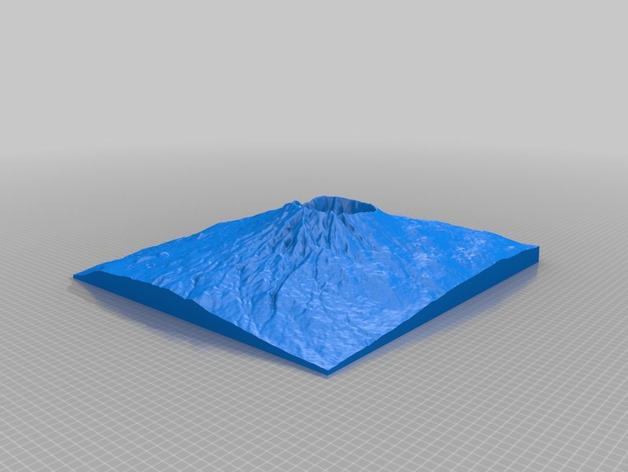
Mount Tambora on the Indonesia archipelago was the site of the largest eruption in recorded history on April 10, 1815. The eruption ejected 160 km3 (38 cu mi) of debris which eventually altered the global climate and turned 1816 in the "Year Without a Summer" affecting North American and European climates. Modern estimates for the deal toll are 71,000 dead with 11,000 -12,000 of those directly from the eruption itself. Two versions of the model are provided with a VE1 and a VE2. High Elevation: 2850 m Low Elevation: -10 m Area: 808 km2 Instructions This model was generated using a program that is currently being developed. It is based on the GMRT dataset (http://www.marine-geo.org/portals/gmrt/) and utilized the interface from GeoMapApp (http://www.geomapapp.org)
With this file you will be able to print Mount Tambora, Indonesia with your 3D printer. Click on the button and save the file on your computer to work, edit or customize your design. You can also find more 3D designs for printers on Mount Tambora, Indonesia.