Mt. Hood
thingiverse
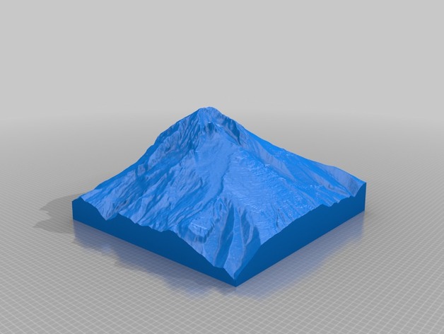
Mt. Hood is the highest point in Oregon State - this model is slightly offset showing more of the southwestern flank of the mountain and the Palmer snowfield. High Elevation: 4320m Low Elevation: 1831m Area: 12 km2 Instructions This model was generated using a program that is currently being developed. It is based on the GMRT dataset (http://www.marine-geo.org/portals/gmrt/) and utilized the interface from GeoMapApp (http://www.geomapapp.org)
Download Model from thingiverse
With this file you will be able to print Mt. Hood with your 3D printer. Click on the button and save the file on your computer to work, edit or customize your design. You can also find more 3D designs for printers on Mt. Hood.