Ordnance Survey Trig Point S3147 at Lickey Hills
myminifactory
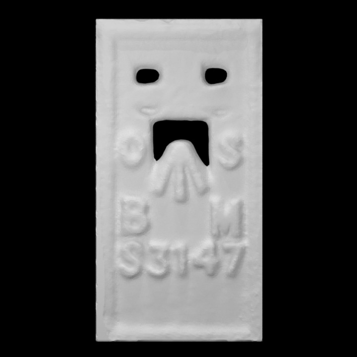
This is a simple scan I did of the Ordnance Surveys's benchmark plate on the trig (short for trigonometry) point at the top of Lickey Hills in Birmigham UK. Trig points like this were located all over the UK and were used for surveying to make maps. These days though many have disappeared or fallen into disrepair as use of GPS for land surveying makes then superfluous. Like many trig points the benchmark plate, which is used for determining height above sea level in surveys, is the Flush Bracket type, as it sat flush with the surface of the plinth or wall it was set into. The bracket part refers to the holes at the top into which a small metal bracket could be inserted that a levelling staff would sit on during surveying. The O and S on the plate refer to the Ordnance Survey and the B and M mean Bench Mark. The S3147 marking is the unique reference number for the trig point. I've found a very interesting web page about this trig point, with details and more photos, so I've put a link below: http://trigpointing.uk/trig/4411 The scan was done with the Sony 3D Creator app on an Xperia XZ1 Compact smartphone, which did a good job of representing the shape.
With this file you will be able to print Ordnance Survey Trig Point S3147 at Lickey Hills with your 3D printer. Click on the button and save the file on your computer to work, edit or customize your design. You can also find more 3D designs for printers on Ordnance Survey Trig Point S3147 at Lickey Hills.