Pinson Mounds State Archaeological Park LiDAR
sketchfab
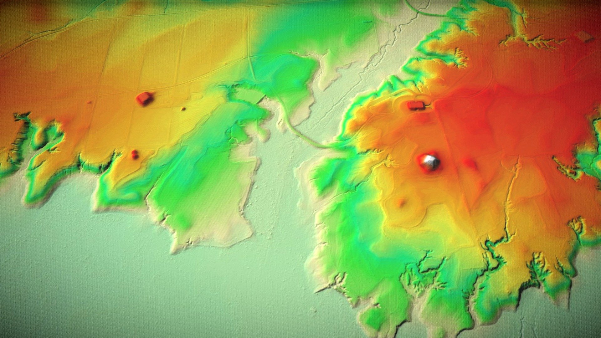
Pinson Mounds is a large prehistoric complex in Madison County, Tennessee. The complex contains 13 mounds, and 3,500 linear feet of earthern geometric enclosure, four-short term ritual-activity areas, and numerous habitation sites. The site was likely occuppied between 100 BC and AD 350, and represents an example of the Hopewell-derived mortuary mound ceremonialism which defined the Middle Woodland period of North American prehistory. Pottery at the site includes Swift Creek designs, likely created by paddles manufactured further east (Georgia/Florida) and locally used to make pots. This model was made using LiDAR data from the USGS National Map. Initial processing of the data was completed in ArcGIS and the final model made with Blender. You can learn more here.
With this file you will be able to print Pinson Mounds State Archaeological Park LiDAR with your 3D printer. Click on the button and save the file on your computer to work, edit or customize your design. You can also find more 3D designs for printers on Pinson Mounds State Archaeological Park LiDAR.