Preliminary model of a talus slope (Swiss Alps)
sketchfab
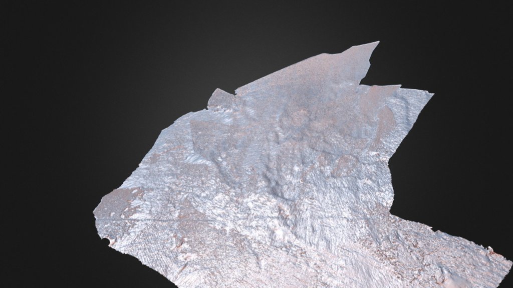
Preliminary model of a part of a talus slope located in the Swiss Alps, Col Du Sanetsch (46°21’13”N 7°18’00”E, 2200 m a.s.l.). According to the Alpine Permafrost Index Map (APIM), no permafrost is present. Microtopography is visible on the slope, indicating the presence of some kind of snow niches. These niches are 5-10m wide approximately. The linear structure visible in the lower part of the slope, is a hiking trail. This model was reconstructed by using a camera stand of 7 m high and ground based photography. The model was georeferenced using detailed RTK GPS measurements (1-3mm) of 15 ground control points. Agisoft photoscanner was used to run the model. The result is a very detailed Digital Elevation Model (8 mm resolution). (45 photos taken by Panasonic Lumix DMC-GF7K + 12-32mm F3.5-5.6)
With this file you will be able to print Preliminary model of a talus slope (Swiss Alps) with your 3D printer. Click on the button and save the file on your computer to work, edit or customize your design. You can also find more 3D designs for printers on Preliminary model of a talus slope (Swiss Alps).