Relief Map of The Sutter Buttes
thingiverse
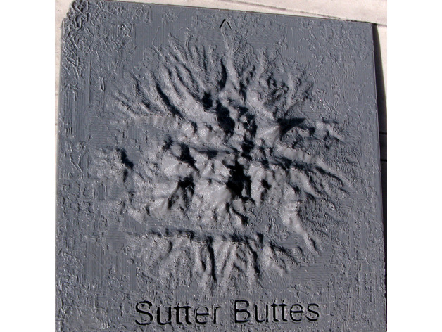
The Sutter Buttes rise as an ancient ring of volcanic domes from the northern Sacramento valley's floor. Located within a single degree by one degree ASTER GEDEM tile, they stand beside the Oroville Dam. A relief map was created with data sampled at three second intervals. The data, along with the Fortran program that generated it and the OpenSCAD program that calculated the map, are included. ASTER GEDEM is a joint product of METI and NASA. Print Settings: Printer Brand: MakerBot Printer: MakerBot Replicator (5th Generation) Rafts: Yes Supports: No Resolution: 0.2 mm According to USGS literature, Dana investigated the Buttes in 1841 and was informed that they served as a winter refuge for deer and antelope during Sacramento valley flooding. Levees were constructed soon after but repeatedly failed, leading to dam construction and a long history of attempts to control flooding. Three Titan missile silos, situated near the Sutter Buttes' edge, were once on active alert but retired in 1965 and have since been dismantled.
With this file you will be able to print Relief Map of The Sutter Buttes with your 3D printer. Click on the button and save the file on your computer to work, edit or customize your design. You can also find more 3D designs for printers on Relief Map of The Sutter Buttes.