Rembrandt basin (Mercury): 3D geo-model
sketchfab
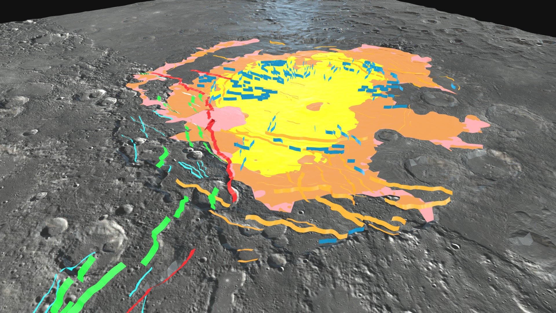
The purpose of the geo-model is to harness all available mapping data to create a detailed, three-dimensional representation of both the structural framework and the thickness of the primary units filling the Rembrandt basin. Rembrandt is a massive 715 km-diameter depression on Mercury situated at 32.89°S, 87.86°E. This crater exemplifies stratigraphic variability, with the uppermost smooth plains of volcanic origin being temporally unrelated to the impact event and distinguished from surrounding smooth plains using spectral information. The basin is bisected in a northeast-southwest direction by an extensive thrust system exceeding 1000 km in length named Enterprise Rupes, primarily attributed to crustal shortening resulting from global contraction. The modeling presented draws heavily on: Semenzato et al., (2020) https://doi.org/10.3390/rs12193213 and Galluzzi et al., (2015) https://doi.org/10.1144/SP401.17 This is part of Deliverable 6.3 of PlanMap H2020. More details on Planmap are available at https://www.planmap.eu
With this file you will be able to print Rembrandt basin (Mercury): 3D geo-model with your 3D printer. Click on the button and save the file on your computer to work, edit or customize your design. You can also find more 3D designs for printers on Rembrandt basin (Mercury): 3D geo-model.